
Thank you for supporting this site ❤️
Make a donation
Make a donation
Pukanec topographic map
Click on the map to display elevation.
Thank you for supporting this site ❤️
Make a donation
Make a donation
Pukanec
The village lies at an altitude of 354 metres and covers an area of 26.196 km2. It has a population of 2067 people. It is located near the Štiavnica Mountains, in the Sikenica river valley. It is located around 18 km northeast of Levice.
Thank you for supporting this site ❤️
Make a donation
Make a donation
About this map
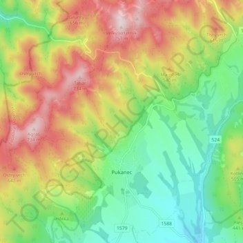
Name: Pukanec topographic map, elevation, terrain.
Average elevation: 462 m
Minimum elevation: 259 m
Maximum elevation: 743 m
Thank you for supporting this site ❤️
Make a donation
Make a donation