
Tegelberg topographic map
Interactive map
Click on the map to display elevation.
About this map
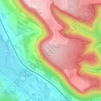
Name: Tegelberg topographic map, elevation, terrain.
Average elevation: 547 m
Minimum elevation: 392 m
Maximum elevation: 703 m
Other topographic maps
Click on a map to view its topography, its elevation and its terrain.
Kuchalb
Deutschland > Baden-Württemberg > Landkreis Göppingen > Donzdorf
Kuchalb, Donzdorf, Gemeindeverwaltungsverband Mittleres Fils-Lautertal, Landkreis Göppingen, Baden-Württemberg, 73329, Deutschland
Average elevation: 557 m