
Sart topographic map
Interactive map
Click on the map to display elevation.
About this map
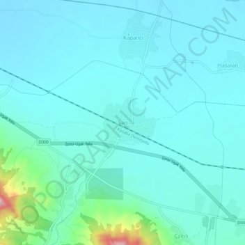
Name: Sart topographic map, elevation, terrain.
Location: Sart, Salihli, Manisa, Région Égéenne, 45450, Turquie (38.47768 28.02326 38.51768 28.06326)
Average elevation: 108 m
Minimum elevation: 71 m
Maximum elevation: 338 m
Other topographic maps
Click on a map to view its topography, its elevation and its terrain.
Seyrantepe
Seyrantepe, Salihli, Manisa, Ege Bölgesi, Turquie
Average elevation: 162 m