
Bischofsheim topographic map
Interactive map
Click on the map to display elevation.
About this map
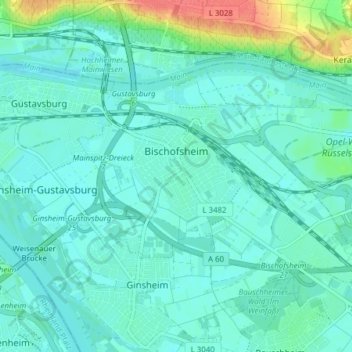
Name: Bischofsheim topographic map, elevation, terrain.
Location: Bischofsheim, Kreis Groß-Gerau, Hesse, Germany (49.97109 8.33316 50.00182 8.41030)
Average elevation: 91 m
Minimum elevation: 81 m
Maximum elevation: 133 m