
Porto Petro topographic map
Interactive map
Click on the map to display elevation.
About this map
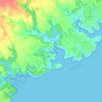
Name: Porto Petro topographic map, elevation, terrain.
Average elevation: 16 m
Minimum elevation: -1 m
Maximum elevation: 60 m
Other topographic maps
Click on a map to view its topography, its elevation and its terrain.
Cala Llombards
Spanien > Balearische Inseln > Migjorn > Santanyí
Cala Llombards, Santanyí, Migjorn, Balearische Inseln, 07690, Spanien
Average elevation: 19 m