
Maro topographic map
Interactive map
Click on the map to display elevation.
About this map
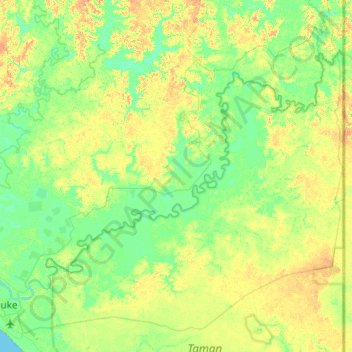
Name: Maro topographic map, elevation, terrain.
Location: Maro, Merauke, Papua, 99616, Indonesia (-8.47988 140.35068 -8.04274 140.98268)
Average elevation: 10 m
Minimum elevation: -1 m
Maximum elevation: 26 m
Other topographic maps
Click on a map to view its topography, its elevation and its terrain.