
Jaiti topographic map
Click on the map to display elevation.
About this map
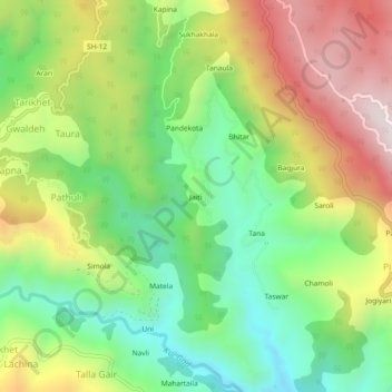
Name: Jaiti topographic map, elevation, terrain.
Location: Jaiti, Ranikhet, Almora District, Uttarakhand, 263645, India (29.58816 79.40652 29.62816 79.44652)
Average elevation: 1,504 m
Minimum elevation: 1,158 m
Maximum elevation: 1,983 m