
Thank you for supporting this site ❤️
Make a donation
Make a donation
Kumpur topographic map
Click on the map to display elevation.
Thank you for supporting this site ❤️
Make a donation
Make a donation
About this map
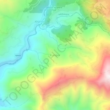
Name: Kumpur topographic map, elevation, terrain.
Location: Kumpur, Siddhalek, Dhading, Bagmati Province, 45100, Nepal (27.83285 84.85153 27.87285 84.89153)
Average elevation: 839 m
Minimum elevation: 428 m
Maximum elevation: 1,534 m
Thank you for supporting this site ❤️
Make a donation
Make a donation
Other topographic maps
Click on a map to view its topography, its elevation and its terrain.