
Lindow (Mark) topographic map
Interactive map
Click on the map to display elevation.
About this map
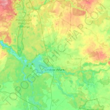
Name: Lindow (Mark) topographic map, elevation, terrain.
Location: Lindow (Mark), Ostprignitz-Ruppin, Brandenburg, Deutschland (52.91483 12.90903 53.07507 13.05100)
Average elevation: 58 m
Minimum elevation: 29 m
Maximum elevation: 106 m