
Herrería topographic map
Interactive map
Click on the map to display elevation.
About this map
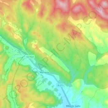
Name: Herrería topographic map, elevation, terrain.
Location: Herrería, Guadalajara, Castile-La Mancha, Spain (40.86546 -1.98742 40.93169 -1.93097)
Average elevation: 1,187 m
Minimum elevation: 1,042 m
Maximum elevation: 1,391 m