
Thank you for supporting this site ❤️
Make a donation
Make a donation
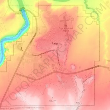
Page topographic map
Click on the map to display elevation.
Thank you for supporting this site ❤️
Make a donation
Make a donation
Page
Page was founded in 1957 as a housing community for workers and their families during the construction of nearby Glen Canyon Dam on the Colorado River. Its 17-square-mile (44 km2) site was obtained in a land exchange with the Navajo Nation. The city is perched atop Manson Mesa at an elevation of 4,300 feet (1,300 m) above sea level and 600 feet (180 m) above Lake Powell.
Thank you for supporting this site ❤️
Make a donation
Make a donation
About this map
Name: Page topographic map, elevation, terrain.
Location: Page, Coconino County, Arizona, United States (36.87436 -111.62198 37.00156 -111.42097)
Average elevation: 1,225 m
Minimum elevation: 941 m
Maximum elevation: 1,465 m
Thank you for supporting this site ❤️
Make a donation
Make a donation
Other topographic maps
Click on a map to view its topography, its elevation and its terrain.