
Monaghan Municipal District topographic map
Interactive map
Click on the map to display elevation.
About this map
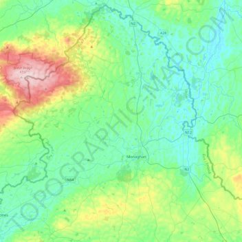
Name: Monaghan Municipal District topographic map, elevation, terrain.
Location: Monaghan Municipal District, County Monaghan, Irland (54.15444 -7.21219 54.42137 -6.73695)
Average elevation: 108 m
Minimum elevation: 28 m
Maximum elevation: 380 m
Other topographic maps
Click on a map to view its topography, its elevation and its terrain.
Carrickmacross-Castleblaney Municipal District
Carrickmacross-Castleblaney Municipal District, County Monaghan, Ulster, Irland
Average elevation: 114 m
Ballybay-Clones Municipal District
Ballybay-Clones Municipal District, County Monaghan, Ulster, Irland
Average elevation: 114 m
Stranoodan
Stranoodan, Caddagh ED, Ballybay-Clones Municipal District, County Monaghan, Irland
Average elevation: 161 m