
Madison County topographic map
Interactive map
Click on the map to display elevation.
About this map
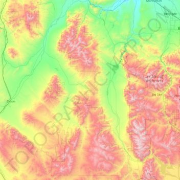
Name: Madison County topographic map, elevation, terrain.
Location: Madison County, Montana, Vereinigte Staaten von Amerika (44.70802 -112.70485 45.85878 -111.35209)
Average elevation: 2,007 m
Minimum elevation: 1,249 m
Maximum elevation: 3,354 m