
Thank you for supporting this site ❤️
Make a donation
Make a donation
Udhampur topographic map
Click on the map to display elevation.
Thank you for supporting this site ❤️
Make a donation
Make a donation
Udhampur
The district of Udhampur is located in the Shivalik range of Himalayas and the terrain is mostly mountainous. The upper reaches of the district experience snowfall in the winter season. The city itself is in a relatively flatter part of the district at an elevation of 756 metres (2480 feet) and it rarely experiences any snowfall.
Thank you for supporting this site ❤️
Make a donation
Make a donation
About this map
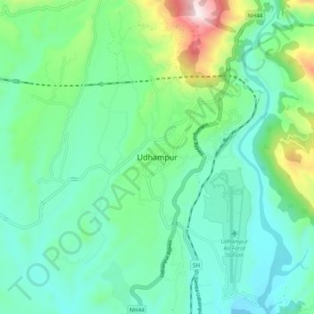
Name: Udhampur topographic map, elevation, terrain.
Location: Udhampur, Udhampur district, Jammu and Kashmir, 182101, India (32.76197 74.97315 33.08197 75.29315)
Average elevation: 1,078 m
Minimum elevation: 333 m
Maximum elevation: 2,672 m
Thank you for supporting this site ❤️
Make a donation
Make a donation