
Thank you for supporting this site ❤️
Make a donation
Make a donation
Higashiyama Ward topographic map
Click on the map to display elevation.
Thank you for supporting this site ❤️
Make a donation
Make a donation
About this map
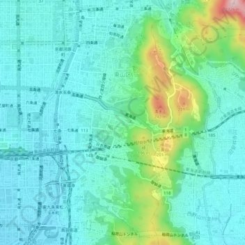
Name: Higashiyama Ward topographic map, elevation, terrain.
Location: Higashiyama Ward, Kyoto, Kyoto Prefecture, Japan (34.96996 135.76464 35.01085 135.79114)
Average elevation: 75 m
Minimum elevation: 22 m
Maximum elevation: 253 m
Thank you for supporting this site ❤️
Make a donation
Make a donation
Other topographic maps
Click on a map to view its topography, its elevation and its terrain.