
Thank you for supporting this site ❤️
Make a donation
Make a donation
El Cerrito topographic map
Click on the map to display elevation.
Thank you for supporting this site ❤️
Make a donation
Make a donation
El Cerrito
According to the United States Census Bureau, the city has a total area of 3.7 square miles (9.6 km2), all of it land. The city is at an elevation of 69 feet (21 m).
Thank you for supporting this site ❤️
Make a donation
Make a donation
About this map
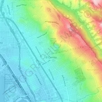
Name: El Cerrito topographic map, elevation, terrain.
Average elevation: 91 m
Minimum elevation: -1 m
Maximum elevation: 307 m
Thank you for supporting this site ❤️
Make a donation
Make a donation