
Vilgert topographic map
Interactive map
Click on the map to display elevation.
About this map
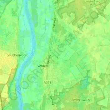
Name: Vilgert topographic map, elevation, terrain.
Location: Vilgert, Velden, Venlo, Limburg, Nederland, 5941 DD, Nederland (51.39950 6.15066 51.43950 6.19066)
Average elevation: 21 m
Minimum elevation: 11 m
Maximum elevation: 29 m
Other topographic maps
Click on a map to view its topography, its elevation and its terrain.
Hasselderheide
Hasselderheide, Velden, Venlo, Limburg, Nederland, 5941 EG, Nederland
Average elevation: 21 m
De Krosselt
De Krosselt, Velden, Venlo, Limburg, Nederland, 5941 AP, Nederland
Average elevation: 22 m