
Thank you for supporting this site ❤️
Make a donation
Make a donation
Denton topographic map
Click on the map to display elevation.
Thank you for supporting this site ❤️
Make a donation
Make a donation
About this map
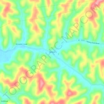
Name: Denton topographic map, elevation, terrain.
Location: Denton, Carter County, Kentucky, 41132, United States (38.24480 -82.88239 38.28480 -82.84239)
Average elevation: 232 m
Minimum elevation: 184 m
Maximum elevation: 295 m
Thank you for supporting this site ❤️
Make a donation
Make a donation
Other topographic maps
Click on a map to view its topography, its elevation and its terrain.