
Saorge topographic map
Interactive map
Click on the map to display elevation.
About this map
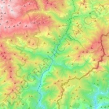
Name: Saorge topographic map, elevation, terrain.
Average elevation: 1,239 m
Minimum elevation: 153 m
Maximum elevation: 2,900 m
Other topographic maps
Click on a map to view its topography, its elevation and its terrain.
Chapelle Sainte-Anne
France > Provence-Alpes-Côte d'Azur > Saorge
Chapelle Sainte-Anne, Saorge, Nice, Alpes-Maritimes, Provence-Alpes-Côte d'Azur, France métropolitaine, 06540, France
Average elevation: 761 m