
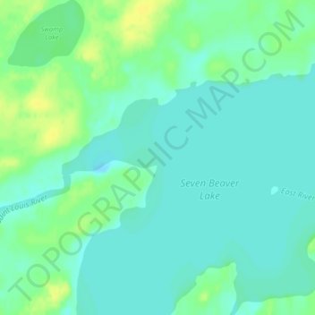
Saint Louis River topographic map
Interactive map
Click on the map to display elevation.
About this map
Name: Saint Louis River topographic map, elevation, terrain.
Average elevation: 509 m
Minimum elevation: 502 m
Maximum elevation: 521 m
Other topographic maps
Click on a map to view its topography, its elevation and its terrain.
Lake Bemidji
Estados Unidos de América > Minnesota > Bemidji
Lake Bemidji, Lakeside Drive Northeast, Bemidji, Beltrami County, Minnesota, 56601, Estados Unidos de América
Average elevation: 415 m
Tug Lake
Estados Unidos de América > Minnesota > Morris
Tug Lake, East 2nd Street, Morris, Stevens County, Minnesota, 56267, Estados Unidos de América
Average elevation: 340 m