
Thank you for supporting this site ❤️
Make a donation
Make a donation
Damanjodi topographic map
Click on the map to display elevation.
Thank you for supporting this site ❤️
Make a donation
Make a donation
About this map
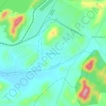
Name: Damanjodi topographic map, elevation, terrain.
Location: Damanjodi, Koraput, Odisha, India (18.73828 82.89064 18.77828 82.93064)
Average elevation: 916 m
Minimum elevation: 866 m
Maximum elevation: 1,069 m
Thank you for supporting this site ❤️
Make a donation
Make a donation