
Kossenblatt topographic map
Interactive map
Click on the map to display elevation.
About this map
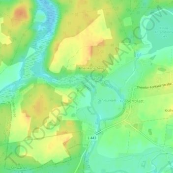
Name: Kossenblatt topographic map, elevation, terrain.
Location: Kossenblatt, Tauche, Oder-Spree, Brandenburg, Deutschland (52.11736 14.06360 52.11771 14.06394)
Average elevation: 51 m
Minimum elevation: 35 m
Maximum elevation: 67 m
Other topographic maps
Click on a map to view its topography, its elevation and its terrain.
Görsdorf
Deutschland > Brandenburg > Tauche
Görsdorf, Tauche, Oder-Spree, Brandenburg, Deutschland
Average elevation: 59 m