
Pforzheimer Hütte topographic map
Interactive map
Click on the map to display elevation.
About this map
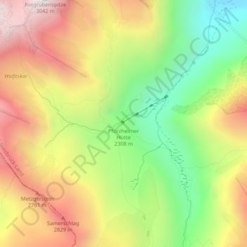
Name: Pforzheimer Hütte topographic map, elevation, terrain.
Average elevation: 2,474 m
Minimum elevation: 1,965 m
Maximum elevation: 3,004 m
Die Pforzheimer Hütte, auch Adolf-Witzenmann-Haus, ist eine Alpenvereinshütte der Sektion Pforzheim des Deutschen Alpenvereins in 2308 m ü. A. Höhe im Gleirschtal in den Stubaier Alpen nahe der Ortschaft St. Sigmund im Sellrain.
Other topographic maps
Click on a map to view its topography, its elevation and its terrain.
Lüsens
Österreich > Tirol > Bezirk Innsbruck-Land > Gemeinde Sankt Sigmund im Sellrain
Lüsens, Gemeinde Sankt Sigmund im Sellrain, Bezirk Innsbruck-Land, Tirol, Österreich
Average elevation: 2,169 m