
Obergurgl topographic map
Interactive map
Click on the map to display elevation.
About this map
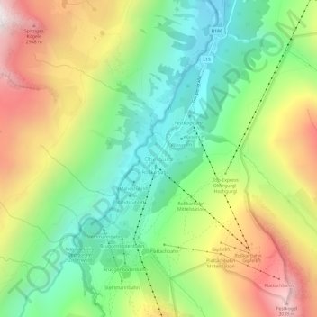
Name: Obergurgl topographic map, elevation, terrain.
Location: Obergurgl, Sölden, Bezirk Imst, Tirol, 6456, Österreich (46.85038 11.00750 46.89038 11.04750)
Average elevation: 2,324 m
Minimum elevation: 1,797 m
Maximum elevation: 3,093 m
Gurgl liegt in den Ötztaler Alpen nahe dem Alpenhauptkamm und ist von bis zu 3500 m hohen Gipfeln und mehreren Gletschern, darunter als größten dem Gurgler Ferner, umgeben. Die Siedlungen liegen im Gurgler Tal in einer Höhe von 1770 m ü. A. bis 2154 m ü. A. (Hochgurgl), Obergurgl gilt mit 1907 m ü. A. als höchstes Kirchdorf Österreichs.