
Torrey topographic map
Interactive map
Click on the map to display elevation.
About this map
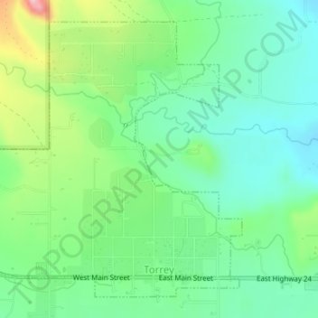
Name: Torrey topographic map, elevation, terrain.
Location: Torrey, Wayne County, Utah, Vereinigte Staaten von Amerika (38.29738 -111.44147 38.32075 -111.41150)
Average elevation: 2,090 m
Minimum elevation: 2,032 m
Maximum elevation: 2,219 m
Torrey liegt auf 38° 18' 6" Nord und 111° 25' 12" West. Zum Zeitpunkt des US Census im Jahr 2000 hatte Torrey 171 Einwohner. Der Ort liegt auf einer Höhe von 2000 m.
Other topographic maps
Click on a map to view its topography, its elevation and its terrain.
Torrey
Vereinigte Staaten von Amerika > Utah > Wayne County > Torrey > Torrey
Torrey, Wayne County, Utah, 84773, Vereinigte Staaten von Amerika
Average elevation: 2,089 m