
Río Napo topographic map
Interactive map
Click on the map to display elevation.
About this map
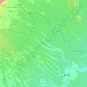
Name: Río Napo topographic map, elevation, terrain.
Location: Río Napo, Provincia de Maynas, Loreto, Perú (-3.49320 -77.92577 -0.40902 -72.63503)
Average elevation: 185 m
Minimum elevation: 72 m
Maximum elevation: 3,432 m
Other topographic maps
Click on a map to view its topography, its elevation and its terrain.