
Thank you for supporting this site ❤️
Make a donation
Make a donation
Rémire topographic map
Click on the map to display elevation.
Thank you for supporting this site ❤️
Make a donation
Make a donation
About this map
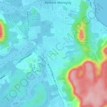
Name: Rémire topographic map, elevation, terrain.
Location: Rémire, Remire-Montjoly, Cayenne, Guyane, 97354, France (4.86578 -52.29882 4.90578 -52.25882)
Average elevation: 36 m
Minimum elevation: -1 m
Maximum elevation: 174 m
Thank you for supporting this site ❤️
Make a donation
Make a donation
Other topographic maps
Click on a map to view its topography, its elevation and its terrain.