
Lac de la Thuile topographic map
Interactive map
Click on the map to display elevation.
About this map
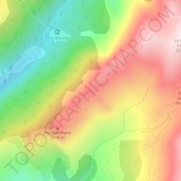
Name: Lac de la Thuile topographic map, elevation, terrain.
Average elevation: 1,861 m
Minimum elevation: 1,456 m
Maximum elevation: 2,266 m
Other topographic maps
Click on a map to view its topography, its elevation and its terrain.
Col de la Madeleine
France > Auvergne-Rhône-Alpes > La Léchère
Col de la Madeleine, D 213, Celliers, La Léchère, Albertville, Savoie, Auvergne-Rhône-Alpes, France métropolitaine, France
Average elevation: 1,981 m