
Conamara Municipal District topographic map
Interactive map
Click on the map to display elevation.
About this map
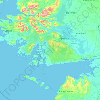
Name: Conamara Municipal District topographic map, elevation, terrain.
Location: Conamara Municipal District, County Galway, Connacht, Ireland (53.04499 -10.31428 53.63730 -9.04929)
Average elevation: 51 m
Minimum elevation: -2 m
Maximum elevation: 786 m
Other topographic maps
Click on a map to view its topography, its elevation and its terrain.
Rossaveel
Rossaveel, Conamara Municipal District, County Galway, Connacht, H91 A2T6, Ireland
Average elevation: 14 m
Portumna
Portumna, Loughrea Municipal District, County Galway, Connacht, Ireland
Average elevation: 40 m
Buffy Lough
Buffy Lough, Oughterard ED, Conamara Municipal District, County Galway, Connacht, Ireland
Average elevation: 84 m