
Struga topographic map
Interactive map
Click on the map to display elevation.
About this map
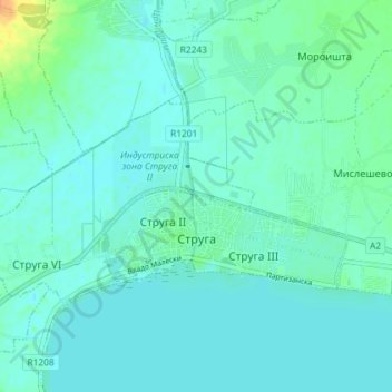
Name: Struga topographic map, elevation, terrain.
Average elevation: 693 m
Minimum elevation: 687 m
Maximum elevation: 720 m
Other topographic maps
Click on a map to view its topography, its elevation and its terrain.
Ohrid
North Macedonia > Southwestern Region
Ohrid, Municipality of Ohrid, Southwestern Region, 6000, North Macedonia
Average elevation: 786 m
Municipality of Debar
North Macedonia > Southwestern Region
Municipality of Debar, Southwestern Region, 1250, North Macedonia
Average elevation: 1,369 m