
Thank you for supporting this site ❤️
Make a donation
Make a donation
Popkum topographic map
Click on the map to display elevation.
Thank you for supporting this site ❤️
Make a donation
Make a donation
About this map
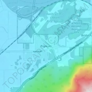
Name: Popkum topographic map, elevation, terrain.
Average elevation: 101 m
Minimum elevation: 11 m
Maximum elevation: 976 m
Thank you for supporting this site ❤️
Make a donation
Make a donation
Other topographic maps
Click on a map to view its topography, its elevation and its terrain.
Jones Lake
Canada > British Columbia > Fraser Valley Regional District > Area D (Popkum/Bridal Falls/Wahleach)
Average elevation: 956 m