
Märzing topographic map
Interactive map
Click on the map to display elevation.
About this map
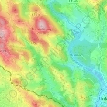
Name: Märzing topographic map, elevation, terrain.
Average elevation: 590 m
Minimum elevation: 491 m
Maximum elevation: 742 m
Other topographic maps
Click on a map to view its topography, its elevation and its terrain.
Rohrbach-Berg
Österreich > Oberösterreich > Bezirk Rohrbach > Rohrbach-Berg
Rohrbach-Berg, Bezirk Rohrbach, Oberösterreich, 4150, Österreich
Average elevation: 582 m