
Thank you for supporting this site ❤️
Make a donation
Make a donation
Ancohuma topographic map
Click on the map to display elevation.
Thank you for supporting this site ❤️
Make a donation
Make a donation
Ancohuma
Angaben über die Höhe des Ancohuma haben in der Vergangenheit zwischen 6550 m und 6423 m geschwankt, und mit 6550 m wäre der Ancohuma noch vor dem Sajama der höchste Berg Boliviens. Im Juli 2005 ist eine 23-köpfige Expedition von „Outpost Wilderness Adventure“ und „Bear Creek Survey Service“ (Colorado, USA) mit Hilfe einer 14 kg schweren GPS-Ausrüstung diesen widersprüchlichen Höhenangaben auf den Grund gegangen. Das Ergebnis ihrer Messungen ist eine Höhenangabe von 6425 m.
Thank you for supporting this site ❤️
Make a donation
Make a donation
About this map
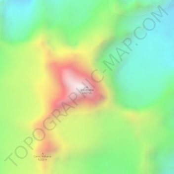
Name: Ancohuma topographic map, elevation, terrain.
Average elevation: 5,895 m
Minimum elevation: 5,525 m
Maximum elevation: 6,408 m
Thank you for supporting this site ❤️
Make a donation
Make a donation