
Endelave topographic map
Interactive map
Click on the map to display elevation.
About this map
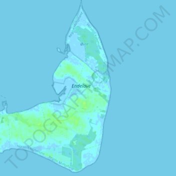
Name: Endelave topographic map, elevation, terrain.
Average elevation: 1 m
Minimum elevation: -2 m
Maximum elevation: 8 m
Other topographic maps
Click on a map to view its topography, its elevation and its terrain.
Hansted
Dänemark > Region Mitteljütland > Horsens > Hansted
Hansted, Horsens, Horsens Kommune, Region Mitteljütland, 8700, Dänemark
Average elevation: 26 m
Horsens
Dänemark > Region Mitteljütland > Horsens
Horsens, Horsens Kommune, Region Mitteljütland, 8700, Dänemark
Average elevation: 51 m