
La Guafilla topographic map
Interactive map
Click on the map to display elevation.
About this map
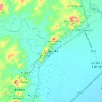
Name: La Guafilla topographic map, elevation, terrain.
Average elevation: 178 m
Minimum elevation: 142 m
Maximum elevation: 329 m
Other topographic maps
Click on a map to view its topography, its elevation and its terrain.
Guanare
Venezuela > Estado Portuguesa > Municipio Guanare
Guanare, Parroquia Capital Guanare, Municipio Guanare, Estado Portuguesa, Venezuela
Average elevation: 180 m