
Kaltbrunn topographic map
Interactive map
Click on the map to display elevation.
About this map
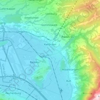
Name: Kaltbrunn topographic map, elevation, terrain.
Location: Kaltbrunn, Wahlkreis See-Gaster, St. Gallen, 8722, Schweiz (47.18511 8.98124 47.23113 9.11474)
Average elevation: 638 m
Minimum elevation: 404 m
Maximum elevation: 1,844 m