
Thank you for supporting this site ❤️
Make a donation
Make a donation
Ethe topographic map
Click on the map to display elevation.
Thank you for supporting this site ❤️
Make a donation
Make a donation
About this map
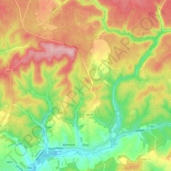
Name: Ethe topographic map, elevation, terrain.
Location: Ethe, Virton, Luxembourg, Wallonia, Belgium (49.57154 5.54974 49.63943 5.63094)
Average elevation: 293 m
Minimum elevation: 205 m
Maximum elevation: 384 m
Thank you for supporting this site ❤️
Make a donation
Make a donation