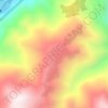
Yingxiu topographic map
Click on the map to display elevation.
Yingxiu
The town has an area of 397.74 square kilometres (153.57 mi2), and a population of 5,829 people as of 2021. The town's average elevation is approximately 900 metres (3,000 ft) above sea level.
About this map

Name: Yingxiu topographic map, elevation, terrain.
Average elevation: 1,582 m
Minimum elevation: 738 m
Maximum elevation: 4,010 m
Other topographic maps
Click on a map to view its topography, its elevation and its terrain.