
Selchow topographic map
Interactive map
Click on the map to display elevation.
About this map
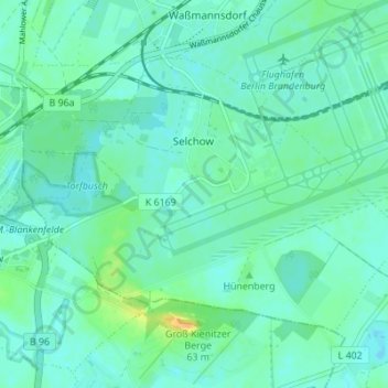
Name: Selchow topographic map, elevation, terrain.
Location: Selchow, Schönefeld, Dahme-Spreewald, Brandenburg, Deutschland (52.33703 13.44191 52.36660 13.51054)
Average elevation: 44 m
Minimum elevation: 37 m
Maximum elevation: 66 m
Other topographic maps
Click on a map to view its topography, its elevation and its terrain.
Ölpfuhl
Deutschland > Brandenburg > Schönefeld
Ölpfuhl, Waltersdorf, Schönefeld, Dahme-Spreewald, Brandenburg, 12526, Deutschland
Average elevation: 44 m