
Thank you for supporting this site ❤️
Make a donation
Make a donation
Pierrette topographic map
Click on the map to display elevation.
Thank you for supporting this site ❤️
Make a donation
Make a donation
About this map
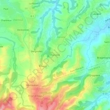
Name: Pierrette topographic map, elevation, terrain.
Location: Pierrette, Lamentin, Basse-Terre, Guadeloupe, 97129, France (16.20408 -61.66555 16.24408 -61.62555)
Average elevation: 66 m
Minimum elevation: 17 m
Maximum elevation: 145 m
Thank you for supporting this site ❤️
Make a donation
Make a donation