
Thank you for supporting this site ❤️
Make a donation
Make a donation
Jefferson County topographic map
Click on the map to display elevation.
Thank you for supporting this site ❤️
Make a donation
Make a donation
About this map
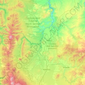
Name: Jefferson County topographic map, elevation, terrain.
Location: Jefferson County, Oregon, United States (44.39027 -121.84946 44.82548 -120.37141)
Average elevation: 1,063 m
Minimum elevation: 311 m
Maximum elevation: 3,113 m
Thank you for supporting this site ❤️
Make a donation
Make a donation
Other topographic maps
Click on a map to view its topography, its elevation and its terrain.