
Thank you for supporting this site ❤️
Make a donation
Make a donation
Isagatedo topographic map
Click on the map to display elevation.
Thank you for supporting this site ❤️
Make a donation
Make a donation
About this map
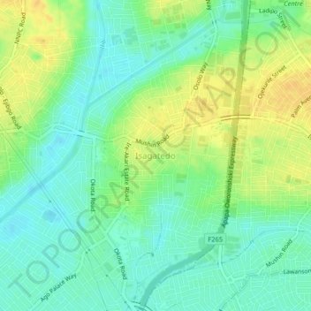
Name: Isagatedo topographic map, elevation, terrain.
Location: Isagatedo, Oshodi/Isolo, Lagos State, 100263, Nigeria (6.50667 3.30583 6.54667 3.34583)
Average elevation: 13 m
Minimum elevation: 0 m
Maximum elevation: 29 m
Thank you for supporting this site ❤️
Make a donation
Make a donation