
Les Jonchiers topographic map
Interactive map
Click on the map to display elevation.
About this map
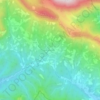
Name: Les Jonchiers topographic map, elevation, terrain.
Average elevation: 599 m
Minimum elevation: 365 m
Maximum elevation: 1,124 m
Other topographic maps
Click on a map to view its topography, its elevation and its terrain.
Beauvoisin
France > Auvergne-Rhône-Alpes > Drôme > Beauvoisin
Beauvoisin, Nyons, Drôme, Auvergne-Rhône-Alpes, France métropolitaine, 26170, France
Average elevation: 645 m