
Thank you for supporting this site ❤️
Make a donation
Make a donation
Woodcreek topographic map
Click on the map to display elevation.
Thank you for supporting this site ❤️
Make a donation
Make a donation
About this map
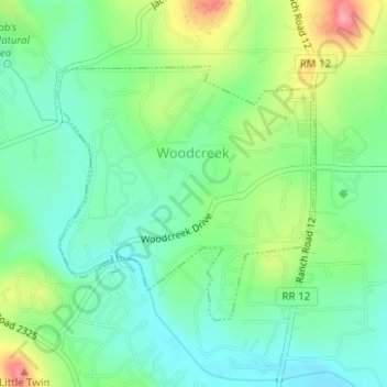
Name: Woodcreek topographic map, elevation, terrain.
Location: Woodcreek, Hays County, Texas, United States (30.01639 -98.12218 30.03453 -98.10131)
Average elevation: 302 m
Minimum elevation: 269 m
Maximum elevation: 366 m
Thank you for supporting this site ❤️
Make a donation
Make a donation
Other topographic maps
Click on a map to view its topography, its elevation and its terrain.