
Ouled Chamekh topographic map
Interactive map
Click on the map to display elevation.
About this map
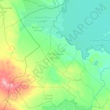
Name: Ouled Chamekh topographic map, elevation, terrain.
Location: Ouled Chamekh, Mahdia, Tunisie (35.36417 10.18592 35.59543 10.46283)
Average elevation: 59 m
Minimum elevation: 24 m
Maximum elevation: 169 m
Other topographic maps
Click on a map to view its topography, its elevation and its terrain.