
Thank you for supporting this site ❤️
Make a donation
Make a donation
Claryville topographic map
Click on the map to display elevation.
Thank you for supporting this site ❤️
Make a donation
Make a donation
About this map
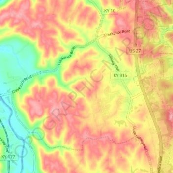
Name: Claryville topographic map, elevation, terrain.
Location: Claryville, Campbell County, Kentucky, 41001, United States (38.89618 -84.44354 38.95004 -84.37824)
Average elevation: 217 m
Minimum elevation: 143 m
Maximum elevation: 269 m
Thank you for supporting this site ❤️
Make a donation
Make a donation
Other topographic maps
Click on a map to view its topography, its elevation and its terrain.