
Industriequartier topographic map
Interactive map
Click on the map to display elevation.
About this map
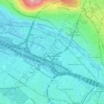
Name: Industriequartier topographic map, elevation, terrain.
Location: Industriequartier, Zürich, Bezirk Zürich, Zürich, 8005, Schweiz (47.37922 8.49836 47.39495 8.53901)
Average elevation: 428 m
Minimum elevation: 398 m
Maximum elevation: 565 m
Other topographic maps
Click on a map to view its topography, its elevation and its terrain.
Wollishofen
Wollishofen, Kreis 2, Zürich, Bezirk Zürich, Zürich, 8038, Schweiz
Average elevation: 446 m
Schwamendingen
Schwamendingen, Zürich, Bezirk Zürich, Zürich, 8051, Schweiz
Average elevation: 478 m
Aussersihl
Aussersihl, Zürich, Bezirk Zürich, Zürich, Schweiz
Average elevation: 418 m