
Vernon topographic map
Interactive map
Click on the map to display elevation.
About this map
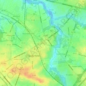
Name: Vernon topographic map, elevation, terrain.
Average elevation: 18 m
Minimum elevation: 2 m
Maximum elevation: 37 m
Other topographic maps
Click on a map to view its topography, its elevation and its terrain.
West Haddonfield
United States > New Jersey > Camden County > Haddonfield
West Haddonfield, Haddonfield, Camden County, New Jersey, 08033, United States
Average elevation: 17 m