
Thank you for supporting this site ❤️
Make a donation
Make a donation
Henley topographic map
Click on the map to display elevation.
Thank you for supporting this site ❤️
Make a donation
Make a donation
About this map
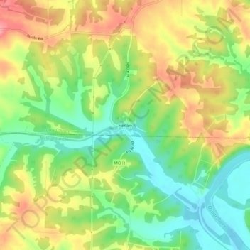
Name: Henley topographic map, elevation, terrain.
Location: Henley, Cole County, Missouri, 65040, United States (38.32448 -92.34240 38.36448 -92.30240)
Average elevation: 211 m
Minimum elevation: 164 m
Maximum elevation: 263 m
Thank you for supporting this site ❤️
Make a donation
Make a donation
Other topographic maps
Click on a map to view its topography, its elevation and its terrain.