
Thank you for supporting this site ❤️
Make a donation
Make a donation
Bogahakumbura topographic map
Click on the map to display elevation.
Thank you for supporting this site ❤️
Make a donation
Make a donation
About this map
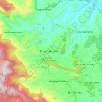
Name: Bogahakumbura topographic map, elevation, terrain.
Location: Bogahakumbura, Badulla District, Uva Province, 90354, Sri Lanka (6.82138 80.83567 6.90138 80.91567)
Average elevation: 1,343 m
Minimum elevation: 1,023 m
Maximum elevation: 1,996 m
Thank you for supporting this site ❤️
Make a donation
Make a donation
Other topographic maps
Click on a map to view its topography, its elevation and its terrain.